We are proud to have provided our services to their utmost satisfaction
Utilities Detection & Mapping Equipment
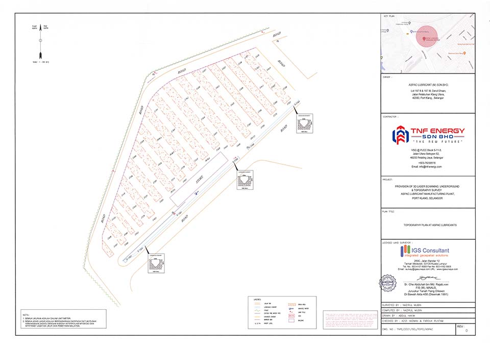
The detected underground infra network can be used as an As-built data and it may be integrated for engineering usage.
The infra network gathered includes electric, gas, telecommunication, water, fiber-optic, road signal and lighting, drains, sewer and major gas and oil pipelines.
Articles Section
Add Your Heading Text Here
Utility Quality Level Attributes by Pekeliling Ketua Pengarah Ukur dan Pemetaan Bil 1 Tahun 2006
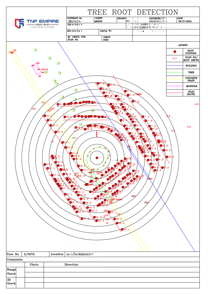
Underground Mapping Procedures
GNSS Control Survey Point
Digital Twin: Sample#1: Above Ground & Underground Design against As-built validation
Previous
Next
Digital Twin: Sample#2: Above Ground & Underground Design against As-built validation